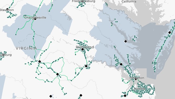
The Commonwealth of Virginia is served by 40 transit agencies operating in 107 localities, with over 2,300 routes and nearly 24,000 bus stops.
This interactive mapping application provides a centralized view of public transportation services across Virginia, including:
- Fixed-route bus stops and routes
- Microtransit service zones
- Demand response service areas
- Intercity bus and rail providers
Users can:
- Toggle individual data layers on or off
- Overlay transit data with additional geographic or demographic layers
- Explore statewide service coverage and identify transit access points
Data Update Schedule:
- Route and stop data: bi-annually
- Other transit data (Microtransit/Demand Response): as DRPT receives notifications of changes
Route and stop data displayed on the map is based on General Transit Feed Specification (GTFS) data, which is available on the statewide clearinghouse page.